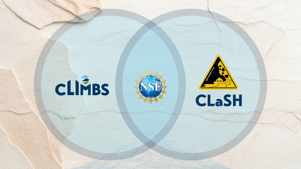
Geologic hazards are complicated, connected, and continuous. While extreme precipitation events can cause catastrophic flooding, the intense precipitation can also induce widespread landslide activity. The landslide deposits can block small streams or send pulses of materials into rivers, exacerbating the destructiveness of the flood by changing the nature of the flow and providing larger debris that can impact infrastructure. Similarly, wildfire burns vegetation making hillslopes more susceptible to landsliding during intense precipitation. The positive feedback between one hazard exacerbating the severity of another hazard is referred to as a hazard cascade. Understanding hazard cascades and their impacts on infrastructure and people is difficult, and exactly the type of challenge addressed through the National Science Foundation’s new Center for Land Surface Hazards (CLaSH). Kentucky researchers are playing a key role.
CLaSH is a center focused on changing how communities understand and prepare for land-surface natural disasters. By studying how landslides, floods, and erosion interact to form “cascading geohazards,” CLaSH seeks to improve understanding and forecasting of these hazards to better predict and warn communities across the United States and the world. CLaSH brings together scientists from across disciplines, institutions, and countries to advance understanding on how connected hazards evolve and how to strengthen community resilience before the next disaster strikes. Rather than studying one event at a time, CLaSH looks at the chain reactions—how one hazard exacerbates the severity or potentially triggers another—and how to use modeling, data, and community partnerships to better prepare for them.
CLaSH aims to transform how researchers and communities study and respond to cascading land hazards by:
- Advancing science that connects storms, soil, and landscape processes to predict future threats.
- Building a national research community that drives innovation in geohazard studies.
- Strengthening community resilience through partnerships that share knowledge and improve preparedness.
- Training the next generation of geoscientists with hands-on fieldwork, disaster engagement, and data-driven skills.
Here in Kentucky, the CLIMBS project casts a complementary vision focused on understanding the conditions under which flooding and landsliding occur, on a more localized scale, and several of its researchers will play a key role in CLaSH. CLIMBS and Kentucky Geological Survey researchers Jason Dortch, Matt Crawford, Ryan Thigpen, and Meredith Swallom, and Hudson Koch are at the intersection of CLIMBS and CLaSH, representing Kentucky’s research voice within the national geologic community. Their expertise in geomorphology, hydrology, earth science education, and links Kentucky’s regional data and Emergency Mitigation Managers with CLaSH’s framework for cascading hazard science will lead to a better understanding of hazard feedbacks and enable better hazard prediction.
Dortch, who is a senior personnel and institutional PI on the CLaSH grant, looks forward to connecting CLIMBS research to CLaSH, building bridges between the two initiatives.
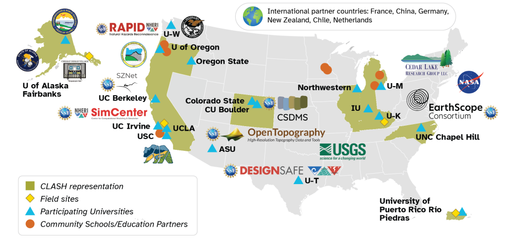
“CLaSH cross-collaborative research laboratories (Alaska, California, Kentucky, and Puerto Rico) will enable a better understanding of how different hazards feedback into each other across topographic and climatic regimes, which will enable the development of more robust modelling tools for future hazard prediction. CLIMBS will provide data, CLaSH personnel will develop modelling software and provide training, and CLIMBS personnel will deploy the new modelling workflows across Kentucky to provide better hazard assessment. Ultimately, with this partnership, we are looking to protect the residents and infrastructure of the Commonwealth of Kentucky.”
Crawford, Thigpen, Swallom, and Koch are key partners in the new center, bringing their expertise about southern Appalachian flooding, landslides, and modeling to help solve hazard resilience issues. “Geohazards are all interrelated, so we are learning that our landslide experts, modelers, and field geologists can develop more effective and novel solutions if we work together. ClaSH is giving us the opportunity to do just that,” says Swallom.
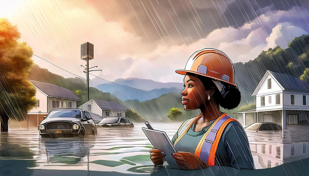
Both programs seek to connect science with people. In the southern Appalachians, where communities have recently faced devastating floods and landslides, the insights from CLIMBS are already shaping how researchers think about real-time hazard forecasting and recovery. Ryan Thigpen, a professor in Earth and Environmental Sciences and KGS Faculty Associate, is co-leading CLIMBS Project 2 with Dortch, which is focused primarily on flood hazards. Thigpen and Dortch are leveraging their considerable experience working in post-disaster settings to help CLIMBS and CLaSH team members learn to respond in disaster-affected areas.
“Critical data that can help us better understand how to prepare for and forecast these events begins to disappear immediately during the post-disaster response. Collecting this “perishable” data is thus a priority for our team, but we never want these efforts to take priority over life-saving operations that are occurring simultaneously,” says Thigpen. “So our goal is to be both scientists and first responders in disaster zones, with the latter taking clear priority on the ground. To do this, we hope to have our on-the-ground teams trained in first aid and search-and-rescue techniques, so that we can work with local first responders to carry out live saving operations where necessary.” That same approach is now contributing to CLaSH’s larger effort to gather critical data that will help model how interconnected hazards evolve under changing climates. CLaSH’s emphasis on data convergence, workforce training, and education partially fulfills CLIMBS’ focus on preparing a new generation of scientists who can combine local field expertise with computational analysis. Through collaborations like these, Kentucky is showing how local innovation can inform global readiness. As CLaSH expands its reach and CLIMBS continues its statewide mission, the link between Kentucky’s communities and international disaster science grows stronger, proving that solutions to global hazards can start right here in the Commonwealth.
To learn more about CLaSH, please visit https://www.geoclash.org/#